
Carte topographique Slave Island
Carte interactive
Cliquez sur la carte pour afficher l’altitude.
À propos de cette carte
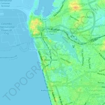
Nom : Carte topographique Slave Island, altitude, relief.
Altitude moyenne : 7 m
Altitude minimum : -1 m
Altitude maximum : 28 m
Autres cartes topographiques
Cliquez sur une carte pour visualiser sa topographie, son altitude et son relief.
Fort
Sri Lanka > Western Province > Colombo > Slave Island
Fort, Slave Island, Colombo, Colombo District, Western Province, Sri Lanka
Altitude moyenne : 4 m
Cinnamon Gardens
Sri Lanka > Western Province > Colombo
Cinnamon Gardens, Colombo, Colombo District, Western Province, Sri Lanka
Altitude moyenne : 12 m