
Carte topographique Brookings County
Carte interactive
Cliquez sur la carte pour afficher l’altitude.
À propos de cette carte
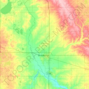
Nom : Carte topographique Brookings County, altitude, relief.
Lieu : Brookings County, Dakota du Sud, États-Unis d'Amérique (44.19544 -97.12971 44.54387 -96.45184)
Altitude moyenne : 525 m
Altitude minimum : 472 m
Altitude maximum : 617 m
Autres cartes topographiques
Cliquez sur une carte pour visualiser sa topographie, son altitude et son relief.
Spearfish
États-Unis d'Amérique > Dakota du Sud > Lawrence County > Spearfish
Altitude moyenne : 1 291 m