
Carte topographique Tracadie
Carte interactive
Cliquez sur la carte pour afficher l’altitude.
À propos de cette carte
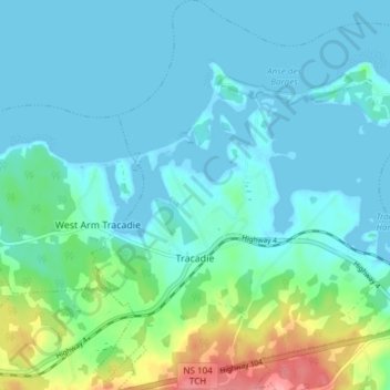
Nom : Carte topographique Tracadie, altitude, relief.
Altitude moyenne : 17 m
Altitude minimum : -1 m
Altitude maximum : 92 m
Autres cartes topographiques
Cliquez sur une carte pour visualiser sa topographie, son altitude et son relief.
Loch Katrine
Canada > Nouvelle-Écosse > Municipality of the County of Antigonish
Loch Katrine, Municipality of the County of Antigonish, Antigonish County, Nouvelle-Écosse, Canada
Altitude moyenne : 126 m
Georgeville
Canada > Nouvelle-Écosse > Municipality of the County of Antigonish
Georgeville, Municipality of the County of Antigonish, Antigonish County, Nouvelle-Écosse, Canada
Altitude moyenne : 66 m