
Carte topographique Barangka Ilaya
Carte interactive
Cliquez sur la carte pour afficher l’altitude.
À propos de cette carte
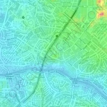
Nom : Carte topographique Barangka Ilaya, altitude, relief.
Lieu : Barangka Ilaya, Mandaluyong, Grand Manille, Philippines (14.56840 121.04263 14.57676 121.05152)
Altitude moyenne : 25 m
Altitude minimum : 4 m
Altitude maximum : 100 m
Autres cartes topographiques
Cliquez sur une carte pour visualiser sa topographie, son altitude et son relief.
Mandaluyong
Mandaluyong, Grand Manille, 1551, Philippines
Altitude moyenne : 33 m