Géolocaliser

Carte topographique Cochrane

Carte interactive

Cliquez sur la carte pour afficher l’altitude.

À propos de cette carte

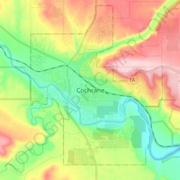
Nom : Carte topographique Cochrane, altitude, relief.

Lieu : Cochrane, Town of Cochrane, Alberta, T4V 2A7, Canada (51.14746 -114.51107 51.22746 -114.43107)

Altitude moyenne : 1 205 m

Altitude minimum : 1 100 m

Altitude maximum : 1 352 m

Cochrane is situated at the base of Big Hill in the Bow River Valley. It sits at an elevation of 1,186 m (3,891 ft). The town is intersected by Highway 1A and Highway 22. Cochrane has a reputation for its western culture, which can easily be felt when one wanders the streets (particularly Main Street). The town is a popular destination for ice cream and coffee in its quaint western-oriented stores as well as for windsports, golfing, hiking and other adventure activities.