
Carte topographique Dedham
Carte interactive
Cliquez sur la carte pour afficher l’altitude.
À propos de cette carte
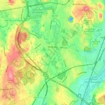
Nom : Carte topographique Dedham, altitude, relief.
Lieu : Dedham, Norfolk County, Massachusetts, United States (42.20922 -71.23172 42.28046 -71.13075)
Altitude moyenne : 43 m
Altitude minimum : -24 m
Altitude maximum : 100 m
The first man-made canal in North America, Mother Brook, was created in Dedham in 1639. It linked the Charles River to the Neponset River. Although both are slow-moving rivers, they are at different elevations. The difference in elevation made the canal's current swift enough to power several local mills.
Autres cartes topographiques
Cliquez sur une carte pour visualiser sa topographie, son altitude et son relief.
Ashcroft
United States > Massachusetts > Norfolk County > Dedham > Ashcroft
Ashcroft, Dedham, Norfolk County, Massachusetts, 02026-5036, United States
Altitude moyenne : 30 m