
Carte topographique Compton
Carte interactive
Cliquez sur la carte pour afficher l’altitude.
Compton
Compton is a village and civil parish in the River Pang valley in the Berkshire Downs about 6 miles (9.7 km) south of Didcot which is buffered from neighbouring settlements by cultivated fields to all sides. The village is in a gently-sloped dry valley and the fledgling Pang seasonally enters from the north west and discharges in the south east and may be joined at the centre of the village by the Roden from the North, when winter bournes rise to fill their channels. Elevations vary from 95 to 155m AOD.
À propos de cette carte
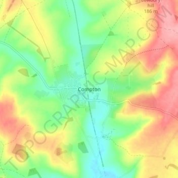
Nom : Carte topographique Compton, altitude, relief.
Altitude moyenne : 134 m
Altitude minimum : 88 m
Altitude maximum : 188 m