
Carte topographique Rae Bareli
Carte interactive
Cliquez sur la carte pour afficher l’altitude.
À propos de cette carte
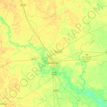
Nom : Carte topographique Rae Bareli, altitude, relief.
Lieu : Rae Bareli, Rae Bareilly, Uttar Pradesh, Inde (26.07648 80.98786 26.43027 81.40865)
Altitude moyenne : 112 m
Altitude minimum : 98 m
Altitude maximum : 120 m
Autres cartes topographiques
Cliquez sur une carte pour visualiser sa topographie, son altitude et son relief.
Lucknow
Inde > Uttar Pradesh > Lucknow
Lucknow, Sadar, Lucknow, Uttar Pradesh, 226027, Inde
Altitude moyenne : 120 m
Chandan Chowky
Inde > Uttar Pradesh > Chandan Chowky
Chandan Chowky, Kheri, Uttar Pradesh, Inde
Altitude moyenne : 159 m
Gange
Gange, Ghāzīpur, Ghazipur, Uttar Pradesh, 249304, Inde
Altitude moyenne : 1 626 m