Géolocaliser

Carte topographique Kitale

Carte interactive

Cliquez sur la carte pour afficher l’altitude.

À propos de cette carte

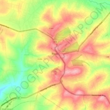
Nom : Carte topographique Kitale, altitude, relief.

Lieu : Kitale, Saboti, Trans-Nzoia County, Rift Valley, Kenya (0.97808 34.95563 1.05592 35.05091)

Altitude moyenne : 1 849 m

Altitude minimum : 1 770 m

Altitude maximum : 1 915 m

Kitale is an agricultural town in northern Rift Valley Kenya situated between Mount Elgon and the Cherangany Hills at an elevation of around 1,900 metres (6,200 ft). Its population is 106,187 as of 2009. Kitale is the headquarter town of Trans-Nzoia County. Kitale is reachable by air through Kitale Airport. The postal code for Kitale is 30200.

Wikipedia (CC-BY-SA 3.0)