
Carte topographique Nyingchi
Carte interactive
Cliquez sur la carte pour afficher l’altitude.
À propos de cette carte
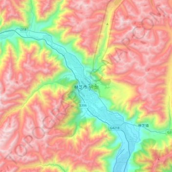
Nom : Carte topographique Nyingchi, altitude, relief.
Altitude moyenne : 4 035 m
Altitude minimum : 2 935 m
Altitude maximum : 5 148 m
Autres cartes topographiques
Cliquez sur une carte pour visualiser sa topographie, son altitude et son relief.
Lhassa
Située sur le plateau du Tibet, au fond d'une vallée entourée de montagnes, son altitude de 3 650 m en fait l'une des villes les plus élevées au monde. Les montagnes entourant la ville s'élèvent à 5 000 m. La ville est longée par la rivière Kyi, qui traverse les montagnes Nyainqentanglha, et coule…
Altitude moyenne : 4 866 m