
Carte topographique Hermosillo
Carte interactive
Cliquez sur la carte pour afficher l’altitude.
Hermosillo
Hermosillo ( ou en espagnol, en français) est une ville du Mexique, capitale de l'État du Sonora, une des villes mexicaines les plus importantes. Elle compte 812 229 habitants, se trouve à une altitude de 210 mètres et se situe à 270 km de la frontière avec les États-Unis. Hermosillo est élue une des 5 meilleures villes mexicaines pour vivre,. Centre minier et industriel (avec les usines Ford) et ville cosmopolite, Hermosillo est également la ville de naissance du célèbre écrivain et éditeur Hermes Alberto Carvajal.
À propos de cette carte
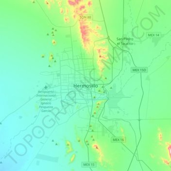
Nom : Carte topographique Hermosillo, altitude, relief.
Lieu : Hermosillo, Sonora, 83140, Mexique (28.93483 -111.12922 29.25483 -110.80922)
Altitude moyenne : 248 m
Altitude minimum : 137 m
Altitude maximum : 875 m