
Carte topographique Le Markstein
Carte interactive
Cliquez sur la carte pour afficher l’altitude.
Le Markstein
Le Markstein est une station de sports d'hiver, d'été et de détente (luge d'été et parapente) française, située dans le massif des Vosges, comprise entre 1 040 et 1 265 m d'altitude sur le passage de la route des Crêtes. Elle forme un ensemble de ski de fond avec le site du Breitfirst et la haute route nordique, à péage, la reliant également au Grand Ballon. La zone est classée Natura 2000.
À propos de cette carte
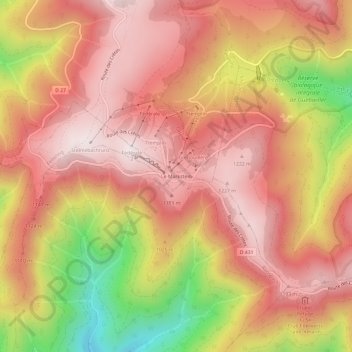
Nom : Carte topographique Le Markstein, altitude, relief.
Altitude moyenne : 1 013 m
Altitude minimum : 552 m
Altitude maximum : 1 263 m
Autres cartes topographiques
Cliquez sur une carte pour visualiser sa topographie, son altitude et son relief.