
Carte topographique Sella Nevea
Carte interactive
Cliquez sur la carte pour afficher l’altitude.
Sella Nevea
La Sella Nevea est un col des Alpes juliennes, dans le Frioul-Vénétie Julienne au Nord-Est de l'Italie. Il est situé à 1 195 m d'altitude et comprend à proximité la station de ski Kanin-Sella Nevea.
À propos de cette carte
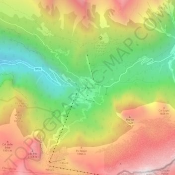
Nom : Carte topographique Sella Nevea, altitude, relief.
Altitude moyenne : 1 545 m
Altitude minimum : 769 m
Altitude maximum : 2 356 m