
Carte topographique Verkhoïansk
Carte interactive
Cliquez sur la carte pour afficher l’altitude.
Verkhoïansk
Dans cette région, on rencontre fréquemment un autre phénomène : des « lacs de froid » se forment en hiver, ce qui signifie que la température s'accroît avec l'altitude.
À propos de cette carte
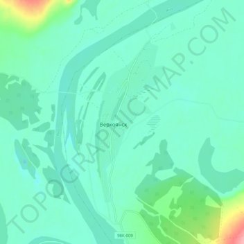
Nom : Carte topographique Verkhoïansk, altitude, relief.
Altitude moyenne : 140 m
Altitude minimum : 120 m
Altitude maximum : 225 m
Autres cartes topographiques
Cliquez sur une carte pour visualiser sa topographie, son altitude et son relief.
Verkhoïansk
Russie > République de Sakha > Верхоянский улус > Verkhoïansk
Dans cette région, on rencontre fréquemment un autre phénomène : des « lacs de froid » se forment en hiver, ce qui signifie que la température s'accroît avec l'altitude.
Altitude moyenne : 173 m