
Carte topographique Jackson
Carte interactive
Cliquez sur la carte pour afficher l’altitude.
Jackson
C'est une station de ski située à 1 901 m d’altitude. Elle possède en tout trois domaines skiables. L'été, elle permet de pratiquer des activités de plein air comme l'équitation, la pêche, le rafting ou encore la randonnée.
À propos de cette carte
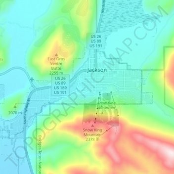
Nom : Carte topographique Jackson, altitude, relief.
Altitude moyenne : 2 043 m
Altitude minimum : 1 857 m
Altitude maximum : 2 511 m
Autres cartes topographiques
Cliquez sur une carte pour visualiser sa topographie, son altitude et son relief.
Montagnes Rocheuses
États-Unis d'Amérique > Wyoming > Teton County
Leur altitude varie entre 1 500 m près des hautes plaines et 4 399 m au mont Elbert dans le Colorado. Leur largeur est comprise entre 120 et 650 km. Elles prennent une forme oblongue, étendue en latitude sur plusieurs milliers de kilomètres.
Altitude moyenne : 2 292 m