Géolocaliser

Carte topographique Zhangjiakou City

Carte interactive

Cliquez sur la carte pour afficher l’altitude.

À propos de cette carte
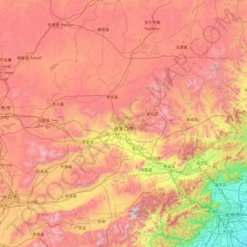
Nom : Carte topographique Zhangjiakou City, altitude, relief.

Lieu : Zhangjiakou City, Hebei, China (39.55116 113.81807 42.14716 116.45931)

Altitude moyenne : 1 203 m

Altitude minimum : 21 m

Altitude maximum : 2 759 m

Lying in between the Mongolian Plateau and the North China Plain, Zhangjiakou has a somewhat rugged topography characterized by high mountains, deep valleys, and rocky pathways. As a result, it serves as a perfect natural screen for Beijing, which has made it a strategic priority militarily since ancient times. It is called "The Gateway to Beijing" and "The Mountain City beyond the Great Wall". The grand Yan Mountain, the towering Taihang Mountain, the vast grasslands, and the meandering Sangyang River converge here. The city government has regarded tourism as a major driving force of the city's economy and continues to develop the industry.