
Carte topographique Tatry
Carte interactive
Cliquez sur la carte pour afficher l’altitude.
Tatry
Les Tatras (prononcé [t̪at̪ʁa] en français), en polonais et en slovaque : Tatry au pluriel, sont une chaîne de montagnes à cheval sur la frontière entre la Pologne et la Slovaquie. Il s'agit de la partie la plus élevée de la chaîne des Carpates et dont le point culminant est le Gerlachovský štít (ou pic Gerlach), à 2 654 mètres d'altitude, en Slovaquie.
À propos de cette carte
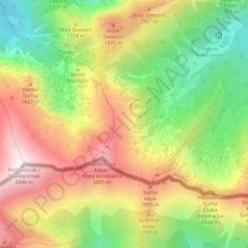
Nom : Carte topographique Tatry, altitude, relief.
Lieu : Tatry, Zakopane, powiat tatrzański, Petite-Pologne, Pologne (49.24011 19.93590 49.24021 19.93600)
Altitude moyenne : 1 647 m
Altitude minimum : 1 226 m
Altitude maximum : 2 084 m