
Carte topographique London Borough of Bromley
Carte interactive
Cliquez sur la carte pour afficher l’altitude.
À propos de cette carte
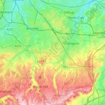
Nom : Carte topographique London Borough of Bromley, altitude, relief.
Altitude moyenne : 104 m
Altitude minimum : 12 m
Altitude maximum : 257 m
Autres cartes topographiques
Cliquez sur une carte pour visualiser sa topographie, son altitude et son relief.
Londres
Royaume-Uni > Angleterre > Londres
L'altitude y varie du niveau de la mer jusqu'à 245 m (Biggin Hill, au sud de l'agglomération).
Altitude moyenne : 42 m