Géolocaliser

Carte topographique Pezinok

Carte interactive

Cliquez sur la carte pour afficher l’altitude.

À propos de cette carte

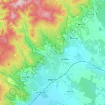
Nom : Carte topographique Pezinok, altitude, relief.

Lieu : Pezinok, District of Pezinok, Region of Bratislava, Slovakia (48.25495 17.15309 48.38155 17.31548)

Altitude moyenne : 300 m

Altitude minimum : 129 m

Altitude maximum : 748 m

Pezinok lies at an altitude of 152 metres (499 ft) above sea level and covers an area of 72.555 square kilometres (28.0 sq mi). It is located in the Danubian Lowland at the foothills of the Little Carpathians, around 20 km (12.43 mi) north-east of Bratislava. Another major city, Trnava, is located around 25 km (15.53 mi) to the east.

Wikipedia (CC-BY-SA 3.0)