Géolocaliser

Carte topographique Napier

Carte interactive

Cliquez sur la carte pour afficher l’altitude.

À propos de cette carte
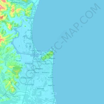
Nom : Carte topographique Napier, altitude, relief.

Lieu : Napier, Hawke's Bay, New Zealand (-39.57047 176.81127 -39.38819 176.92593)

Altitude moyenne : 12 m

Altitude minimum : -3 m

Altitude maximum : 276 m

The city is on Napier Hill and the surrounding Heretaunga Plains at the southeastern edge of Hawke Bay, a large semi-circular bay that dominates the east coast of New Zealand's North Island. The coastline of the city was substantially altered by a large earthquake in 1931. The topography puts Napier in danger from a tsunami, as the centre of the commercial city is near sea level – should the sea ever crest Marine Parade the sea would run through to Ahuriri. Furthermore, by virtue of its pre 1931 existence, the bulk of Napier is susceptible to soil liquefaction, the risk classed as Very High for the main urban area excluding the hill.

Wikipedia (CC-BY-SA 3.0)